This is one a a series of articles published in Longstanton Life between February 2016 and the present, showing just how often dire warnings were issued about the destruction of Longstanton’s groundwater, and just how often they were ignored by those whose duty it was to take timely action.
Hilary Stroude wrote:
Longstanton residents should be aware of a very real problem that lies beneath their feet!
Longstanton residents and Heritage Society members should be aware of a very real problem that lies beneath their feet! Longstanton stands on a gravel bed, out of sight some distance below its surface. For countless years it has acted as a hidden reservoir of water flowing slowly in a natural underground ‘stream’ lying mainly on an impermeable lay of clay. It has acted for centuries as a conduit that has permitted the local water table to stabilise, subject only to natural variations in the rainfall. Now, Phase 1 drainage work and gravel extraction are having a detrimental affect on this water table (ie. the water levels beneath the surface).
 The digging of two wide and deep ditches below the top of this gravel seam leading to the new constructed balancing pond close to the Guided Bus Way, is likely to be a major cause of these reported drops in the locally observed water levels. It’s effect is now being felt in licensed wells, ponds and more seriously will quite possibly, destabilise foundations of older properties, constructed of bricks and mortar, all lying over and close to this band of gravel. This depletion of water is likely to affect all buildings within Longstanton’s Conservation Area and our two ancient churches of All Saints’ and St Michael’s.
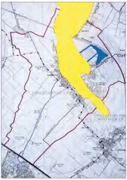
The illustration shows the Longstanton boundary (red) and the approximate location of the gravel bed (yellow), and, importantly, the large ditches (blue) that have been cut, apparently to drain water from the gravel bed to the balancing ponds.
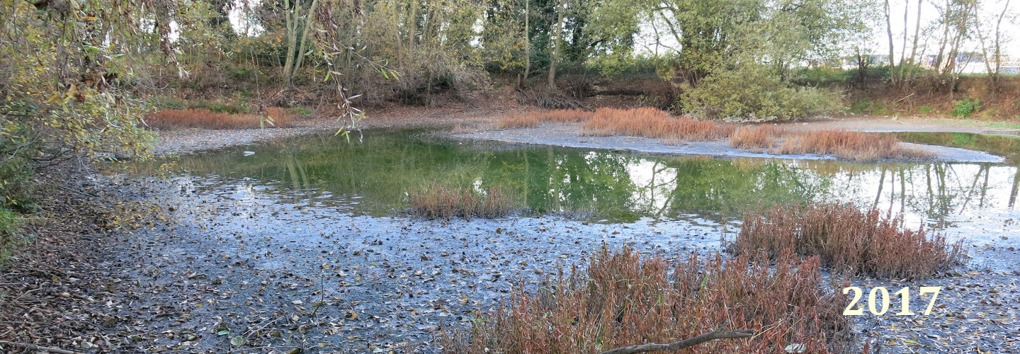
A recent mining of gravel of, some say an industrial scale, between the Kingfisher and other ponds in the area undoubtedly is responsible for a disruption in the established water flow in the gravel seam. Similarly, any water loss is destroying the habitats for protected species, i.e. kingfishers, great crested newts and water voles. Already, the water levels in the Kingfisher pond and other open ponds are recording an approximate drop of 3ft/1m. A local well that has a protected Water Abstraction Licence has also reported a serious 4ft/1.3m depletion and this when it’s winter and the water table is usually high. The landowner, who relies on water to irrigate horticultural produce during the summer months, is understandably very concerned. Of course, we realise that the half of the village that has been subjected to flash flooding, devastating many homes, may not be too interested in hearing about this apparently rather less important problem. But nevertheless, it’s one that is likely to affect All Saints’ and St Michael’s end of the village on higher ground away from the poorly maintained Longstanton brook and its clogged conduits.
Construction of the Cambridge Guided Bus concrete tracks, some 3 years ago, manufactured on site a short distance from our Park & Ride area, should have provided a wake up call. Water for this process was drawn from a pond created for the purpose that is still to be seen to the right of the entrance to the P & R car park. It acted as almost a very shallow well from which a continuous supply of water could be drawn by the very fact it sat over this gravel band. It too, quite possibly, disturbed the village’s water table but the effects only lasted a relatively short time.